Freycinet’s map of south-eastern Tasmania, made on Baudin’s 1800-1804 voyage. Notice how accurately Bruny Island is mapped, compared to the Tasman Peninsula, to the right.
Friends of North Bruny facilitates cooperation between North Bruny’s communities, government and other organisations. Find out more about north Bruny Island – what to do, where to go.
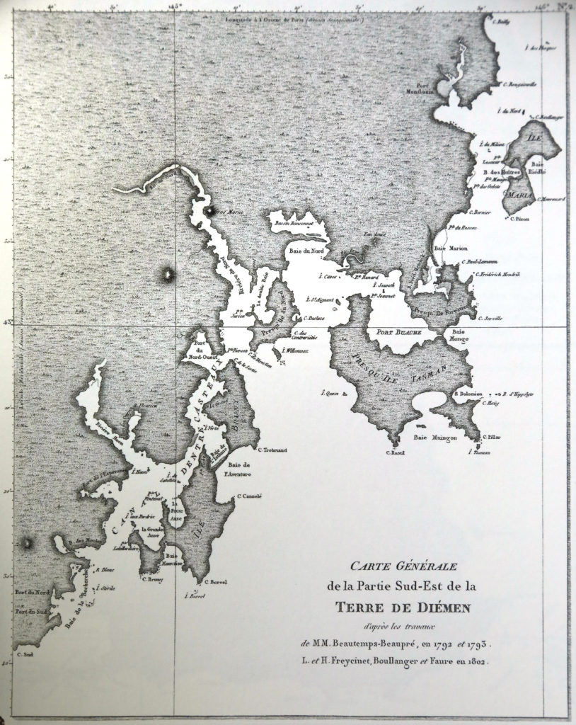
Freycinet’s map of south-eastern Tasmania, made on Baudin’s 1800-1804 voyage. Notice how accurately Bruny Island is mapped, compared to the Tasman Peninsula, to the right.